Liste der Landschaftsschutzgebiete im Landkreis Cuxhaven
Die Liste der Landschaftsschutzgebiete im Landkreis Cuxhaven enthält die Landschaftsschutzgebiete des Landkreises Cuxhaven in Niedersachsen.
| Bild | Nummer | Bezeichnung des Gebietes | Fläche in Hektar | WDPA-ID | Koordinaten[1] | Datum der Verordnung |
|---|---|---|---|---|---|---|
| LSG CUX 00027 | Quellental, Fahlenberg und Silberberg | 48,90 | 323722 | Position53.73159.05734 | 1938 | |
| LSG CUX 00028 | Bremerscher Gutspark Cadenberge | 12,50 | 320082 | Position53.7749.06631 | 1938 | |
 | LSG CUX 00029 | Burganlage bei der Pulvermühle | 0,30 | 320191 | Position53.67379.12556 | 1938 |
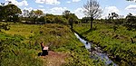
| LSG CUX 00031 | Hollbecker- und Kiekerberg | 66,20 | 321726 | Position53.67479.10561 | 1938 | |
| LSG CUX 00032 | Paschberg | 2,00 | 323646 | Position53.57399.10486 | 1943 | |
| LSG CUX 00033 | Westerseiter Hochmoor/ Krodonswiesen | 250,00 | 325822 | Position53.68878.80941 | 1976 | |
| LSG CUX 00034 | Bullensee/ Reckin-Berg/ Knüllensmoor | 324,00 | 320176 | Position53.57519.016 | 1976 | |
 | LSG CUX 00035 | Pipinsburg und Umland | 637,00 | 323678 | Position53.6658.6179 | 1982 |
| LSG CUX 00036 | Heidegelände mit 10 Hügelgräbern | 5,00 | 321506 | Position53.65538.65144 | 1937 | |
 | LSG CUX 00038 | Hügelgräber in der Hotfeldheide und Schulreith | 3,00 | 321816 | Position53.5298.76242 | 1937 |
| LSG CUX 00039 | Gehölz am Weißen Berg | 22,20 | 321023 | Position53.36768.59727 | 1938 | |
| LSG CUX 00041 | Siebenbergensheide | 1,00 | 324553 | Position53.36618.66174 | 1938 | |
| LSG CUX 00042 | Dannenkamp | 4,50 | 320276 | Position53.54248.68279 | 1938 | |
 | LSG CUX 00043 | Friedheimer See | 5,00 | 320895 | Position53.52238.66486 | 1938 |
| LSG CUX 00044 | Monsilienburg | 2,10 | 323029 | Position53.42128.86038 | 1939 | |
| LSG CUX 00045 | Waldgebiete bei Bederkesa | 1431,50 | 325600 | Position53.61248.7709 | 1939 | |
 | LSG CUX 00046 | Gehölz bei Schiffdorf | 1,50 | 321024 | Position53.51468.6747 | 1940 |
| LSG CUX 00048 | Liethberg | 1,00 | 322606 | Position53.62718.89032 | 1952 | |
| LSG CUX 00049 | Wöhlkens Forst | 4,60 | 325930 | Position53.73348.63087 | 1954 | |
| LSG CUX 00050 | Amtswiesen | 14,00 | 319630 | Position53.63138.83919 | 1961 | |
| LSG CUX 00051 | Interessentenforst westlich Düring | 30,00 | 321960 | Position53.45418.65665 | 1962 | |
| LSG CUX 00052 | Interessentenforst südöstlich Düring | 11,50 | 321959 | Position53.45428.68256 | 1962 | |
| LSG CUX 00053 | Häsebruch | 35,00 | 321408 | Position53.39388.68334 | 1962 | |
| LSG CUX 00054 | Hollener Heide | 232,00 | 321729 | Position53.41548.72356 | 1975 | |
| LSG CUX 00055 | Amtsgehölz | 0,40 | 319628 | Position53.68938.56315 | 1970 | |
| LSG CUX 00056 | Obere Geeste | 581,00 | 323337 | Position53.50778.92362 | 1971 | |
| LSG CUX 00057 | Osterndorfer Moor | 727,00 | 323572 | Position53.45838.86223 | 1973 | |
| LSG CUX 00058 | 33 alte Eichen in Wiemsdorf | 1,20 | 319416 | Position53.44758.52263 | 1960 | |
 | LSG CUX 00059 | Apeler See und Umland | 96,00 | 319649 | Position53.50888.6525 | 1979 |
| LSG CUX-S 00001 | Friedhof der St. Abunduskirche mit Baumbestand | 0,30 | 320900 | Position53.84078.72723 | 1922 | |
| LSG CUX-S 00002 | Friedhof der St. Gertrudenkirche mit Baumbestand | 0,30 | 320901 | Position53.88318.67223 | 1922 | |
 | LSG CUX-S 00003 | Umgebung der Martinskirche mit Baumbestand | 1,00 | 325281 | Position53.85698.70134 | 1922 |
| LSG CUX-S 00004 | Der Schloßpark von Ritzebüttel | 7,40 | 320324 | Position53.85718.69722 | 1938 | |
| LSG CUX-S 00005 | Brockeswald | 16,90 | 320097 | Position53.86588.65107 | 1938 | |
| LSG CUX-S 00006 | Altenwalder Höhe mit Burg | 4,50 | 319537 | Position53.82258.66108 | 1938 | |
| LSG CUX-S 00007 | Alte Schanze | 1,50 | 319519 | Position53.81598.67532 | 1940 | |
| LSG CUX-S 00008 | Fünf Berge | 2,30 | 320932 | Position53.79818.66828 | 1938 | |
| LSG CUX-S 00009 | Fort Kugelbake | 4,70 | 320858 | Position53.88998.68074 | 1991 | |
| LSG CUX-S 00010 | Spanger Berg | 0,10 | 324711 | Position53.85368.63992 | 1933 | |
| LSG CUX-S 00011 | Galgenberg | 0,80 | 320946 | Position53.86838.641 | 1938 | |
| LSG CUX-S 00012 | Baum- und Strauchbestand im ehemaligen Fort Thomsen | 8,10 | 319813 | Position53.87988.65209 | 1953 | |
| LSG CUX-S 00013 | Baumgruppe Nordostecke des Ritzebütteler Friedhofs | 0,30 | 319830 | Position53.85628.70365 | 1953 | |
| LSG CUX-S 00014 | Wernerwald | 302,50 | 325775 | Position53.85158.59822 | 1938 | |
| LSG CUX-S 00015 | Fuchsbusch | 1,40 | 320913 | Position53.84258.63404 | 1938 | |
| LSG CUX-S 00016 | Sahlenburger Wacholderheide | 8,50 | 324067 | Position53.86038.60482 | 1998 | |
| LSG CUX-S 00018 | Hügelgräber bei Berensch | 0,60 | 321811 | Position53.80868.59832 | 1938 | |
| LSG CUX-S 00020 | Waldstreifen zwischen Wernerwald und Küstenwald | 2,30 | 325621 | Position53.83618.58082 | 1960 | |
| LSG CUX-S 00021 | Küstenwald | 7,40 | 325621 | Position53.8298.58002 | 1960 | |
| LSG CUX-S 00022 | Küstenheide - Eichenkratt | 5,00 | 322376 | Position53.81288.58437 | 1939 |
Anmerkungen
- ↑ Koordinaten wurden dem European Nature Information System (EUNIS) der Europäischen Umweltagentur entnommen: Nationally designated areas (CDDA), Datei CDDA_v12_csv.zip, Stand Oktober 2014. Die Tabellenspalte WDPA-ID gibt die genauen Grenzen an.
Siehe auch
- Liste der Naturschutzgebiete im Landkreis Cuxhaven
- Liste der Naturdenkmale im Landkreis Cuxhaven
- Liste der geschützten Landschaftsbestandteile im Landkreis Cuxhaven
- Liste der Geotope im Landkreis Cuxhaven
Weblinks
Commons: Landschaftsschutzgebiete im Landkreis Cuxhaven – Sammlung von Bildern, Videos und Audiodateien
- Datenquelle
- Karte mit allen Koordinaten:
- OSM
- WikiMap

Ammerland | Aurich | Braunschweig | Celle | Cloppenburg | Cuxhaven | Delmenhorst | Diepholz | Emden | Emsland | Friesland | Gifhorn | Goslar | Göttingen | Grafschaft Bentheim | Hameln-Pyrmont | Region Hannover | Harburg | Heidekreis | Helmstedt | Hildesheim | Holzminden | Leer | Lüchow-Dannenberg | Lüneburg | Nienburg/Weser | Northeim | Oldenburg (Land) | Oldenburg (Stadt) | Osnabrück (Land) | Osnabrück (Stadt) | Osterholz | Peine | Rotenburg (Wümme) | Salzgitter | Schaumburg | Stade | Uelzen | Vechta | Verden | Wesermarsch | Wilhelmshaven | Wittmund | Wolfenbüttel | Wolfsburg


