Barrier Ranges

Barrier is located in New South Wales
Barrier
Barrier
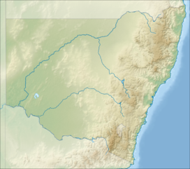
Location of the Barrier Range in New South Wales near the South Australian border
Highest pointPeakMount Robe, 31°39′24″S 141°19′36″E / 31.656680°S 141.326776°E / -31.656680; 141.326776Elevation472[1] m (1,549 ft)[2]
AHDCoordinates31°42′S 141°15′E / 31.700°S 141.250°E / -31.700; 141.250[3]GeographyCountryAustraliaStateNew South WalesRange coordinates31°30′S 141°30′E / 31.500°S 141.500°E / -31.500; 141.500[4]

The Barrier Ranges or sometimes the Barrier Range and historically the Stanley's Barrier Range, is a mountain range that comprises a series of hills and higher grounds in the far western region of New South Wales, Australia, surrounding the city of Broken Hill.

Location and features

The Barrier Ranges comprise the whole system of ranges and ridges associated with the main watershed named the Main Barrier Range - including Coko Range, Floods Range, Slate Range, Robe Range, Mundi Mundi Range, Coonbaralba Range and Mount Darling Range. The city of Broken Hill lies within these ranges.[4]

The ranges is oriented in a roughly north-south direction, east of the border between New South Wales and South Australia. It is an area of slightly higher ground lying between the lower lands along the Darling River, and lower ground in South Australia. The Barrier Ranges contains a number of mineral deposits, most notably Broken Hill.

It was reported in October 1856 that, 'within the last year or two numerous sheep-stations have been opened in the Barrier Ranges, affording a reasonable prospect, not only of increased pastoral wealth, but also of the gradual development of the mineral resources of the district and its ultimate settlement.'[5]

Etymology

The name of the Barrier Highway and various local organisations in Broken Hill including the word 'barrier', are derived from the name of this range. In 1844, during his third and final expedition, Charles Sturt named the range Stanley's Barrier Range in honour of Lord Stanley.[6]

See also

  • flagNew South Wales portal
  • iconMountains portal

References

  1. ^ Quigley, Mark Cameron (September 2006). Continental tectonics and landscape evolution in south-central Australia and southern Tibet (PDF). Retrieved 16 June 2019.
  2. ^ "Map of Barrier Ranges, NSW". Bonzle Digital of Australia. Retrieved 6 May 2015.
  3. ^ "Lewis Peak". Geographical Names Register (GNR) of NSW. Geographical Names Board of New South Wales. Retrieved 6 May 2015. Edit this at Wikidata
  4. ^ a b "Barrier Ranges". Geographical Names Register (GNR) of NSW. Geographical Names Board of New South Wales. Retrieved 6 May 2015. Edit this at Wikidata
  5. ^ South Australian Register newspaper, 15 October 1856, page 2.
  6. ^ Cumpston, John Howard Lidgett (1951). Charles Sturt - His Life and Journeys of Exploration. Melbourne: Georgian House. Retrieved 4 December 2012.
  • v
  • t
  • e
Coastal mountain ranges
(not part of the
Great Dividing Range)
Mid North Coast
  • Middle Brother (554 m or 1,818 ft)
  • South Brother (487 m or 1,598 ft)
  • North Brother (476 m or 1,562 ft)
Allyn, Barrington
& Mount Royal
  • Brumlow Tops (1,586 m or 5,203 ft)
  • Polblue (1,575 m or 5,167 ft)
  • Barrington (1,555 m or 5,102 ft)
  • Careys Peak (1,544 m or 5,066 ft)
  • Eremeren Point (1,537 m or 5,043 ft)
  • Royal (1,185 m or 3,888 ft)
  • Allyn (1,125 m or 3,691 ft)
  • Cabrebald (1,000 m or 3,281 ft)
  • Ben Bullen
  • Gunama
  • Lumeah
Gibraltar and Sugarloaf
Blue Mountains
  • Coricudgy (1,255 m or 4,117 ft)
  • unnamed peak (1,189 m or 3,901 ft)
  • Pomany (1,109 m or 3,638 ft)
  • Piddington (1,094 m or 3,589 ft)
  • Boyce (1,093 m or 3,586 ft)
  • York (1,061 m or 3,481 ft)
  • Victoria (1,059 m or 3,474 ft)
  • Banks (1,049 m or 3,442 ft)
  • Tomah (1,016 m or 3,333 ft)
  • Wilson (1,008 m or 3,307 ft)
  • Kings Tableland (1,000 m or 3,281 ft)
  • Narrow Neck Plateau (1,000 m or 3,281 ft)
  • Bell (998 m or 3,274 ft)
  • Castle Cliff (986 m or 3,235 ft)
  • Solitary (950 m or 3,117 ft)
  • Hay (944 m or 3,097 ft)
  • Podgers (890 m or 2,920 ft)
  • Irvine (850 m or 2,789 ft)
  • Debert (840 m or 2,756 ft)
  • Camp Cave (800 m or 2,625 ft)
  • Warrigal (760 m or 2,493 ft)
  • Notts (750 m or 2,461 ft)
  • Harris (736 m or 2,415 ft)
  • Centre (620 m or 2,034 ft)
  • Hall (617 m or 2,024 ft)
  • Gibson (608 m or 1,995 ft)
  • Scorpion (558 m or 1,831 ft)
  • Linda Rock (599 m or 1,965 ft)
  • Cookem (569 m or 1,867 ft)
  • Gospers
  • Bedford
  • Cameron
  • Coriaday
  • Erskine
  • Mistake
  • Monundilla
  • Whaite
  • Wirraba
  • Pearces
  • Wedding Cake
Illawarra
  • Bells (803 m or 2,635 ft)
  • Knights Hill (709 m or 2,326 ft)
  • Noorinan (663 m or 2,175 ft)
  • Saddleback (600 m or 1,969 ft)
  • Wanyambilli Hill (564 m or 1,850 ft)
  • Kembla (534 m or 1,752 ft)
  • Burelli (531 m or 1,742 ft)
  • Kembla West (512 m or 1,680 ft)
  • Brisbane (469 m or 1,539 ft)
  • Keira (464 m or 1,522 ft)
  • Warra (464 m or 1,522 ft)
  • Brokers Nose (440 m or 1,444 ft)
  • Nebo (252 m or 827 ft)
The Budawangs
  • Budawang (1,129 m or 3,704 ft)
  • Currockbilly (1,087 m or 3,566 ft)
  • Wog Wog (893 m or 2,930 ft)
  • Cole (876 m or 2,874 ft)
  • Sturgiss (858 m or 2,815 ft)
  • Fosters (857 m or 2,812 ft)
  • Barneys Hill (855 m or 2,805 ft)
  • The Castle (831 m or 2,726 ft)
  • Shrouded Gods (809 m or 2,654 ft)
  • Donjon (786 m or 2,579 ft)
  • Clyde (781 m or 2,562 ft)
  • Quiltys (775 m or 2,543 ft)
  • Wirritin (674 m or 2,211 ft)
  • Pigeon House / Didthul (720 m or 2,362 ft)
  • Bushwalker (640 m or 2,100 ft)
  • Byangee (500 m or 1,640 ft)
  • Coolangatta
  • Tarn
Great Dividing Range
Tweed
  • Warning (1,156 m or 3,793 ft)
  • Bar (1,130 m or 3,707 ft)
  • Glenugie (316 m or 1,037 ft)
  • Chincogan (260 m or 853 ft)
  • Gladstone
  • Goobergooberyam
  • Moombil
McPherson and Nightcap
  • Barney (1,359 m or 4,459 ft)
  • Burrell 933 m or 3,061 ft)
  • Neville (919 m or 3,015 ft)
  • Nardi (812 m or 2,664 ft)
  • Matheson (804 m or 2,638 ft)
  • Peates (604 m or 1,982 ft)
Mid North Coast
Nandewar
  • Kaputar (1,489 m or 4,885 ft)
  • Dowe (1,457 m or 4,780 ft)
  • Mount Coryah (1,409 m or 4,623 ft)
  • Lindesay (1,373 m or 4,505 ft)
  • Grattai (1,301 m or 4,268 ft)
  • Bushy (1,260 m or 4,134 ft)
  • Round (1,250 m or 4,101 ft)
  • Yulludunida (1,225 m or 4,019 ft)
  • Castle Top (1,120 m or 3,675 ft)
  • Gins (1,120 m or 3,675 ft)
  • Ningadhun (1,013 m or 3,323 ft)
Liverpool and Watagan
  • unnamed (1,300 m or 4,265 ft)
  • Pandoras Pass (788 m or 2,585 ft)
  • Warrawolong (641 m or 2,103 ft)
New England and Moonbi
  • Round (1,585 m or 5,200 ft)
  • Point Lookout (1,564 m or 5,131 ft)
  • Ben Lomond (1,512 m or 4,961 ft)
  • Grundy (1,463 m or 4,800 ft)
  • Barren (1,437 m or 4,715 ft)
  • Hyland (1,434 m or 4,705 ft)
  • Duval (1,393 m or 4,570 ft)
  • Black Jack (1,300 m or 4,265 ft)
  • Gulligal (1,230 m or 4,035 ft)
  • Oaky (1,070 m or 3,510 ft)
  • Cooee (1,020 m or 3,346 ft)
  • Flaggy (984 m or 3,228 ft)
  • Big Billy (884 m or 2,900 ft)
  • Dorrigo (762 m or 2,500 ft)
  • Burning (520 m or 1,706 ft)
  • Yarrowyck
Central Tablelands
  • Canobolas (1,395 m or 4,577 ft)
  • Shooters Hill (1,394 m or 4,573 ft)
  • Bindo (1,363 m or 4,472 ft)
  • Trickett (1,362 m or 4,469 ft)
  • Blaxland (901 m or 2,956 ft)
  • Hopeless (1,056 m or 3,465 ft)
The Brindabellas and Scabby
  • Bimberi (1,913 m or 6,276 ft)
  • Gingera (1,857 m or 6,093 ft)
  • Kelly (1,829 m or 6,001 ft)
  • Ginini (1,762 m or 5,781 ft)
  • Franklin (1,646 m or 5,400 ft)
  • Aggie (1,421 m or 4,662 ft)
  • Coree (1,421 m or 4,662 ft)
  • Bramina (1,392 m or 4,567 ft)
  • Bulls Head (1,375 m or 4,511 ft)
  • Black Bottle (1,356 m or 4,449 ft)
  • Lickhole (1,188 m or 3,898 ft)
  • Brindabella (972 m or 3,189 ft)
Monaro
  • Big Badja (1,363 m or 4,472 ft)
  • Brown (1,243 m or 4,078 ft)
  • Gibraltar (Bungendore) (887 m or 2,910 ft)
  • Gibraltar Hill
Snowies
Main
  • Kosciuszko (2,228 m or 7,310 ft)
  • Townsend (2,209 m or 7,247 ft)
  • unnamed peak on Etheridge Ridge (2,180 m or 7,152 ft)
  • Alice Rawson Peak (2,160 m or 7,087 ft)
  • Byatts Camp (2,159 m or 7,083 ft)
  • Carruthers (2,145 m or 7,037 ft)
  • Abbott Peak (2,145 m or 7,037 ft)
  • Mount Northcote (2,131 m or 6,991 ft)
  • Muellers Peak (2,120 m or 6,955 ft)
  • Clark (2,100 m or 6,890 ft)
  • Lee (2,100 m or 6,890 ft)
  • Gungartan (2,068 m or 6,785 ft)
  • Tate (2,068 m or 6,785 ft)
  • Jagungal (2,061 m or 6,762 ft)
  • Perisher (2,054 m or 6,739 ft)
  • Stilwell (2,040 m or 6,693 ft)
  • Watsons Crags (2,020 m or 6,627 ft)
  • Back Perisher (2,014 m or 6,608 ft)
  • Anton (2,000 m or 6,562 ft)
  • Anderson (1,997 m or 6,552 ft)
  • Blue Cow (1,994 m or 6,542 ft)
  • The Granite Peaks (1,980 m or 6,496 ft)
  • Dicky Cooper Bogong (1,980 m or 6,496 ft)
  • Gills Knobs (1,940 m or 6,365 ft)
  • Guthega Peak (1,924 m or 6,312 ft)
  • Blue Calf (1,905 m or 6,250 ft)
  • Sentinel (1,900 m or 6,234 ft)
  • Mount Piper (1,830 m or 6,004 ft)
  • Round (1,756 m or 5,761 ft)
Ramshead
  • Rams Head (2,190 m or 7,185 ft)
  • Twynam (2,178 m or 7,146 ft)
  • Rams Head North (2,177 m or 7,142 ft)
  • Little Twynam (2,120 m or 6,955 ft)
Other mountains in the GDR
  • Yengo (668 m or 2,192 ft)
Inland mountain ranges
Barrier
  • Lewis Peak (297 m or 974 ft)
Warrumbungles
  • Exmouth (1,206 m or 3,957 ft)
  • Woorut (1,165 m or 3,822 ft)
  • Needle
Other inland mountains
Island mountain ranges
Lord Howe
Mountains not within
a specific range
  • Gibraltar (863 m or 2,831 ft)
  • Gulaga (806 m or 2,644 ft)
  • Ulandra (761 m or 2,497 ft)
  • Tilga (329 m or 1,079 ft)
  • Oxley (307 m or 1,007 ft)