California Historical Landmarks in Fresno County
Map all coordinates using OpenStreetMap
Download coordinates as:
- KML
- GPX (all coordinates)
- GPX (primary coordinates)
- GPX (secondary coordinates)
List table of the properties and districts — listed on the California Historical Landmarks — within Fresno County, Northern California.
- Note: Click the "Map of all coordinates" link to the right to view a Google map of all properties and districts with latitude and longitude coordinates in the table below.
Listings
| Image | [1] | Landmark name | Location | City or town | Summary |
|---|---|---|---|---|---|
 | 344 | Arroyo de Cantúa | Dorris Ave. & State Hwy 33 36°14′47″N 120°18′53″W / 36.246483°N 120.314817°W / 36.246483; -120.314817 (Arroyo de Cantúa) | Coalinga | |
 | 916 | Forestiere Underground Gardens | 5021 W. Shaw Ave. 36°48′26″N 119°52′51″W / 36.807222°N 119.880833°W / 36.807222; -119.880833 (Forestiere Underground Gardens) | Fresno | Also on the NRHP list as NPS-77000293 |
 | 584 | Fort Miller | Millerton Lake State Recreation Area 37°00′55″N 119°39′34″W / 37.015278°N 119.659444°W / 37.015278; -119.659444 (Fort Miller) | Friant | |
 Upload Photo | 488 | Fresno City | Fresno Slough 36°39′40″N 120°15′40″W / 36.661111°N 120.261111°W / 36.661111; -120.261111 (Fresno City) | Tranquillity | |
 | 873 | Site of the Fresno Free Speech Fight of the Industrial Workers of the World | Mariposa Street and Congo Alley in the Fulton Mall (Fresno) 36°44′04″N 119°47′30″W / 36.7345°N 119.791667°W / 36.7345; -119.791667 (Site of the Fresno Free Speech Fight of the Industrial Workers of the World) | Fresno | |
Upload Photo | 803 | Site of the first junior college in California | Stanislaus St. & O St. 36°44′32″N 119°47′23″W / 36.7421°N 119.7897°W / 36.7421; -119.7897 (Site of the first junior college in California) | Fresno | |
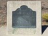
 | 934 | Temporary Detention Camps for Japanese Americans - Fresno Assembly Center | Big Fresno Fairgrounds 36°43′53″N 119°45′03″W / 36.731517°N 119.750733°W / 36.731517; -119.750733 (Temporary Detention Camps for Japanese Americans - Fresno Assembly Center) | Fresno | |
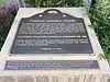 | 934 | Temporary Detention Camps for Japanese Americans - Pinedale Assembly Center | 625 W. Alluvial Ave. 36°50′40″N 119°48′15″W / 36.84431°N 119.8042°W / 36.84431; -119.8042 (Temporary Detention Camps for Japanese Americans - Pinedale Assembly Center) | Pinedale |
References
- ^ "California Historical Landmarks By County". Ohp.parks.ca.gov. Retrieved 2019-04-03.
See also
Wikimedia Commons has media related to California Historical Landmarks in Fresno County, California.
- List of California Historical Landmarks
- National Register of Historic Places listings in Fresno County, California
- v
- t
- e
| |||||||||||||||||
National Forests and Grasslands | |||||||
|---|---|---|---|---|---|---|---|
| |||||||
|
| |||||||
| |||||||
|
|
- Heritage registers
- National Natural Landmarks


