Cuchara, Colorado
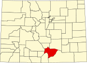
Unincorporated community in Huerfano County, Colorado, United States
Unincorporated community in Colorado, United States
37°22′45″N 105°06′01″W / 37.37917°N 105.10028°W / 37.37917; -105.1002881055[1]
Cuchara is an unincorporated community in Huerfano County, Colorado, United States. It is located near a former ski resort in the mountains south of the town of La Veta.[3] Its altitude is 8,468 feet (2,581 m).[4] State Highway 12 travels through Cuchara as it approaches Trinidad to the southeast.
Description
Cuchara is situated on the eastern slopes of the Sangre de Cristo Mountains in south-central Colorado. It is west of the Spanish Peaks. Cucharas Pass, at almost 10,000 feet, is a few miles south of the town of Cuchara. The Cucharas River flows on the outskirts of town. The San Isabel National Forest surrounds the town.[3]
In Spanish, "cuchara" means "spoon," reflecting the area's valley being so shaped.[5] A large number of locations are listed as having the name of "Cuchara" or some derivation there of in Huerfano County, including Cuchara Junction northeast of Walsenburg and the Cuchara Formation.[6]
This small town has a few small businesses such as restaurants and small hotels or lodges. This is a midpoint for stopping along the scenic State Highway 12.[7]
History
In the summer of 2018, Cuchara was evacuated due to a wildfire that threatened the town in the middle of their peak season. The evacuation caused local businesses to suffer financially.[8]
References
 Colorado portal

- ^ "Cuchara, CO ZIP Code - United States". codigo-postal.co. Retrieved March 16, 2020.
- ^ "Cuchara, Colorado". Geographic Names Information System. United States Geological Survey, United States Department of the Interior. October 13, 1978. Retrieved March 16, 2020.
- ^ a b "Cuchara, Colorado" Sangres.com. Retrieved 23 July 2009.
- ^ U.S. Geological Survey Geographic Names Information System: Cuchara, Colorado
- ^ Dawson, John Frank (1954). "Cuchara". Place Names in Colorado: Why 700 Communities Were So Named. p. 16. Retrieved March 16, 2020.
- ^ US Geographical Survey (October 13, 1978). "Cuchara Junction". GNIS. Retrieved March 16, 2020.
- ^ "Cuchara Vacations, Activities & Things To Do | Colorado.com". www.colorado.com. Retrieved April 11, 2019.
- ^ Severancy, Ryan (July 9, 2018). "Cuchara businesses suffering while village is evacuated for the Spring Fire". The Pueblo Chieftain. Retrieved April 11, 2019.
External links
![]() Media related to Cuchara, Colorado at Wikimedia Commons
Media related to Cuchara, Colorado at Wikimedia Commons
- v
- t
- e
Municipalities and communities of Huerfano County, Colorado, United States
County seat: Walsenburg
communities
- Colorado portal
- United States portal
 | This Colorado state location article is a stub. You can help Wikipedia by expanding it. |
- v
- t
- e


