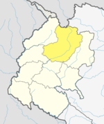
Durgathali Rural Municipality
Rural Municipality in Sudurpashchim Province, Nepal
Durgathali Rural Municipality दुर्गाथली गाउँपालिका | |
|---|---|
Rural Municipality | |
| 29°31′45″N 81°00′23″E / 29.52906°N 81.0063°E / 29.52906; 81.0063 | |
| Country |  Nepal Nepal |
| Province | Sudurpashchim Province |
| District | Bajhang District |
| Government | |
| • Type | Local government |
| Area | |
| • Total | 61.83 km2 (23.87 sq mi) |
| Population (2011 census) | |
| • Total | 12,972 |
| • Density | 210/km2 (540/sq mi) |
| Time zone | UTC+05:45 (Nepal Standard Time) |
| Website | http://durgathalimun.gov.np |
Durgathali (Nepali: दुर्गाथली) is a Gaupalika(Nepali: गाउपालिका ; gaupalika) in Bajhang District in the Sudurpashchim Province of far-western Nepal.[1]
Durgathali has a population of 12972. The land area is 61.83 km2.[2]
References
- v
- t
- e
Bajhang District
Headquarters: Jayaprithvi
- Jayaprithvi
- Bungal
- Banjh
- Bagthala
- Bhairabnath
- Bhamchaur
- Bhatekhola
- Byasi
- Chaudhari
- Dahabagar
- Dangaji
- Dantola
- Daulichaur
- Deulekh
- Deulikot
- Dhamena
- Gadaraya
- Jayaprithvi
- Kadal
- Kailash
- Kalukheti
- Kanda
- Kaphalaseri
- Khiratadi
- Koiralakot
- Kot Bhairab
- Kotdewal
- Lamatola
- Lekhgaun
- Majhigaun
- Malumela
- Mashdev
- Matela
- Maulali
- Melbisauni
- Parakatne
- Patadewal
- Pauwagadhi
- Pitatola
- Pipalkot
- Rayal
- Rilu
- Sainpasela
- Sunikot
- Sunkuda
- Surma
- Syandi
- Thalara
List of municipalities and rural municipalities of Nepal


