Gauri, Kapilvastu
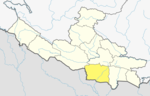
Village development committee in Lumbini Zone, Nepal
Gauri गौरी | |
|---|---|
Village development committee | |
| 27°31′N 83°04′E / 27.51°N 83.07°E / 27.51; 83.07 | |
| Country |  Nepal Nepal |
| Zone | Lumbini Zone |
| District | Kapilvastu District |
| Population (1991) | |
| • Total | 2,935 |
| Time zone | UTC+5:45 (Nepal Time) |
Gauri is a village development committee in Kapilvastu District in the Lumbini Zone of southern Nepal. At the time of the 1991 Nepal census it had a population of 2935 people living in 447 individual households.[1]
References
- ^ "Nepal Census 2001". Nepal's Village Development Committees. Digital Himalaya. Archived from the original on 12 October 2008. Retrieved 14 December 2008.
- v
- t
- e
Kapilvastu District
Headquarters: Kapilvastu Municipality
- Kapilvastu
- Banganga
- Buddhabhumi
- Shivaraj
- Krishnanagar
- Maharajganj
- Abhirawa
- Ajingara
- Bahadurganj
- Balarampur
- Baluhawa
- Bangai
- Baraipur
- Basantapur
- Baskhaur
- Bedauli
- Bhagawanpur Choti
- Bhalabari
- Bhrikuti Municipality
- Bijuwa
- Bithuwa
- Dhankauli
- Dharampaniya
- Dohani
- Dubiya
- Dumara
- Phulika
- Gajehada
- Ganeshpur
- Gauri
- Gotihawa
- Gugauli
- Haranampur
- Hardauna
- Hathausa
- Hathihawa
- Jahadi
- Jayanagar
- Kajarhawa
- Khurhuriya
- Kopawa
- Kushawa
- Labani
- Lalpur
- Mahendrakot
- Mahuwa
- Malwar
- Manpur
- Milmi
- Motipur
- Nanda Nagar
- Nigalihawa
- Pakadi
- Parsohiya
- Patariya
- Patna
- Patthardaihiya
- Pipari
- Purusottampur
- Ramghat
- Ramnagar
- Rangapur
- Sauraha
- Shivagadhi
- Shivapur Palta
- Shivaraj Municipality
- Singhkhor
- Sisawa
- Somdiha
- Thunhiya
- Tilaurakot
- Titirkhi
- Udayapur
- Vidhyanagar
List of municipalities and rural municipalities of Nepal
 | This article about a location in Kapilvastu District, Nepal is a stub. You can help Wikipedia by expanding it. |
- v
- t
- e


