Golden View Colony, South Dakota
Census-designated place in South Dakota, United States
43°41′44″N 97°26′55″W / 43.69556°N 97.44861°W / 43.69556; -97.44861 (2020)[3]
57058 (Salem)
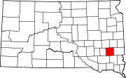
Golden View Colony is a census-designated place (CDP) corresponding to the Goldenview Hutterite colony[4] in McCook County, South Dakota, United States. The population was 95 at the 2020 census.[5] It was first listed as a CDP prior to the 2020 census.[2]
It is in the west-central part of the county, 5 miles (8 km) by road southwest of Salem, the county seat.
Demographics
| Census | Pop. | Note | %± |
|---|---|---|---|
| 2020 | 95 | — | |
| U.S. Decennial Census[6] | |||
References
- ^ "ArcGIS REST Services Directory". United States Census Bureau. Retrieved October 15, 2022.
- ^ a b c U.S. Geological Survey Geographic Names Information System: Golden View Colony, South Dakota
- ^ "Census Population API". United States Census Bureau. Retrieved October 15, 2022.
- ^ Friesen, Bert (May 2021). "Goldenview Hutterite Colony (Salem, South Dakota, USA)". Global Anabaptist Mennonite Encyclopedia Online. Retrieved September 16, 2021.
- ^ "U.S. Census Bureau: Golden View Colony CDP, South Dakota". www.census.gov. United States Census Bureau. Retrieved March 19, 2022.
- ^ "Census of Population and Housing". Census.gov. Retrieved June 4, 2016.
- v
- t
- e
Municipalities and communities of McCook County, South Dakota, United States
County seat: Salem
- Golden View Colony
- Orland Colony
community
- South Dakota portal
- United States portal
 | This South Dakota state location article is a stub. You can help Wikipedia by expanding it. |
- v
- t
- e


