Grabo, Ivory Coast
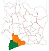
Place in Bas-Sassandra, Ivory Coast
4°55′N 7°30′W / 4.917°N 7.500°W / 4.917; -7.500 Ivory Coast
 (2014)[1]
Grabo is a town in south-western Ivory Coast. It is a sub-prefecture and commune of Tabou Department in San-Pédro Region, Bas-Sassandra District. The town is three kilometres east of the Cavally River, which forms the border with Liberia.
In 2014, the population of the sub-prefecture of Grabo was 39,181.[2]
Villages
The nineteen villages of the sub-prefecture of Grabo and their population in 2014 are:[2]
- Déblablai (1 080)
- Djimané (103)
- Dougbo (317)
- Fêtè (518)
- Gbapet (2 729)
- Grabo (8 980)
- Négbatchi (6 139)
- Nouin (349)
- Siahé (1 618)
- Gbahiro (748)
- Gnato (12 803)
- Guikla (119)
- Ouesséto (163)
- Podoué (1 295)
- Sioulo (324)
- Soklodogba (501)
- Soto (950)
- Tiboto (221)
- Woté (224)
References
- ^ "Cote d'Ivoire population statistics". GeoHive. Archived from the original on 22 December 2015. Retrieved 8 December 2015.
- ^ a b "RGPH 2014, Répertoire des localités, Région San-Pédro" (PDF). ins.ci. Retrieved 5 August 2019.
- v
- t
- e
Departments and sub-prefectures of San-Pédro Region, Bas-Sassandra DistrictRegional seat: San-Pédro
- Dapo-Iboké
- Djamandioké
- Djouroutou
- Grabo*
- Olodio
- Tabou*
* also a commune
 | This Bas-Sassandra District location article is a stub. You can help Wikipedia by expanding it. |
- v
- t
- e


