Hoceinia
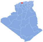
Place in Aïn Defla, Algeria
Hoceinia | |
|---|---|
| Nickname: Bouhalouane | |
| Country | Algeria |
| Province | Aïn Defla |
| Time zone | UTC+1 (West Africa Time) |
Hoceinia is a town in Northern Algeria and situated in the eastern side of Ain-Defla province. It is about 96km in the west of the capital Algiers. Traversed by important highways like RN4, the A1(Autoroute West-Ouest) and Algiers-Oran railway. Also, it is bordered by the municipalities of Boumedfaa, Djendel,Ain Soltane, Ain-Torki, and Ain Al-Baniane.
 Algeria portal

- v
- t
- e

Capital: Aïn Defla
- Aïn Defla
- Aïn Lechiakh
- Bathia
- Bordj El Amir Khaled
- Boumedfaâ
- Djendel
- Djelida
- El Abadia
- El Amra
- El Attaf
- Hammam Righa
- Khemis
- Miliana
- Rouina
- Aïn Bénian
- Aïn Bouyahia
- Aïn Defla
- Aïn Lechiakh
- Aïn Soltane
- Aïn Torki
- Arib
- Barbouche
- Bathia
- Bellas
- Ben Allal
- Bir Ould Khelifa
- Bordj Emir Khaled Chikh
- Bouchared
- Boumedfaa
- Djelida
- Djemaa Ouled
- Djendel
- El Abadia
- El Amra
- El Attaf
- El Hassania
- El Maine
- Hammam Righa
- Hoceinia
- Khemis Miliana
- Mekhatria
- Miliana
- Oued Chorfa
- Oued Djemaa
- Rouina
- Sidi Lakhdar
- Tacheta Zougagha
- Tarik Ibn Ziad
- Tiberkanine
- Zeddine
36°19′N 2°24′E / 36.317°N 2.400°E / 36.317; 2.400
 | This article about a location in Aïn Defla Province is a stub. You can help Wikipedia by expanding it. |
- v
- t
- e


