List of ports in Sri Lanka
The following is a list of ports in Sri Lanka. All ports and harbours in Sri Lanka are maintained and governed by the Government of Sri Lanka and the Sri Lanka Ports Authority.
List of ports

| Name | City | Location | Description |
|---|---|---|---|
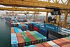
| Port of Colombo | Colombo | 06°57′10″N 79°50′41″E / 6.95278°N 79.84472°E / 6.95278; 79.84472 (Port of Colombo) | Largest port in the country |
| Port of Hambantota | Hambantota | 06°07′10″N 81°06′29″E / 6.11944°N 81.10806°E / 6.11944; 81.10806 (Port of Hambantota) | New port in the south |
| Trincomalee Harbour | Trincomalee | 08°34′01″N 81°13′52″E / 8.56694°N 81.23111°E / 8.56694; 81.23111 (Trincomalee Harbour) | Fourth largest natural harbour in the world |
| Port of Galle | Galle | Regional Port | |
| Port of Point Pedro | Point Pedro | 09°50′09″N 80°12′41″E / 9.83583°N 80.21139°E / 9.83583; 80.21139 (Port of Point Pedro) | Minor harbour, the northernmost in the country |
| Kankesanthurai Harbour | Kankesanthurai | 09°49′08″N 80°01′57″E / 9.81889°N 80.03250°E / 9.81889; 80.03250 (Kankesanthurai Harbour) | Minor harbour, currently used by the navy |
| Oluvil Harbour | Oluvil | 07°16′30″N 81°52′00″E / 7.27500°N 81.86667°E / 7.27500; 81.86667 (Oluvil) | Newly developed harbour opened 2013 |
| Kalpitiya Port Of Norochcholai | Norochcholai | 08°01′50″N 79°42′07″E / 8.03056°N 79.70194°E / 8.03056; 79.70194 (Norochcholai) | Used for Coal Transportation |
See also
 Sri Lanka portal

External links
Map all coordinates using OpenStreetMap
Download coordinates as:
- KML
- GPX (all coordinates)
- GPX (primary coordinates)
- GPX (secondary coordinates)
- Sri Lanka Ports Authority
- Ministry of Ports & Aviation
- v
- t
- e
Ports and harbours of Sri Lanka
- Port of Jambukola
- Port of Mahatittha
- Port of Mathoddam
- Port of Urkavalthurai
Under construction
| |
|---|---|
| Types |
|
| Rankings | |
| Locations | |
| Port management | |
| Conventions | |
| |


| |||||||||
|---|---|---|---|---|---|---|---|---|---|
| Companies | |||||||||
| Currency, Governance |
| ||||||||
| History |
| ||||||||
| People |
| ||||||||
| Promotion | |||||||||
| Sectors |
| ||||||||
| International cooperation | |||||||||
| See also | |||||||||
| |||||||||

List of ports in Asia | |
|---|---|
| Sovereign states |
|
| States with limited recognition |
|
| Dependencies and other territories |
|
| |


