Lom (Strakonice District)
Municipality in South Bohemian, Czech Republic
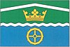
Flag
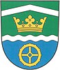
Coat of arms
 Czech Republic
 (2024-01-01)[1]
388 01
Lom is a municipality and village in Strakonice District in the South Bohemian Region of the Czech Republic. It has about 100 inhabitants.
Lom lies approximately 18 kilometres (11 mi) north of Strakonice, 61 km (38 mi) north-west of České Budějovice, and 82 km (51 mi) south-west of Prague.
Administrative parts
The village of Míreč is an administrative part of Lom.
Demographics
| Year | Pop. | ±% |
|---|---|---|
| 1869 | 365 | — |
| 1880 | 376 | +3.0% |
| 1890 | 356 | −5.3% |
| 1900 | 321 | −9.8% |
| 1910 | 348 | +8.4% |
| 1921 | 360 | +3.4% |
| 1930 | 329 | −8.6% |
| 1950 | 240 | −27.1% |
| 1961 | 229 | −4.6% |
| 1970 | 196 | −14.4% |
| 1980 | 180 | −8.2% |
| 1991 | 135 | −25.0% |
| 2001 | 124 | −8.1% |
| 2011 | 100 | −19.4% |
| 2021 | 86 | −14.0% |
| Source: Censuses[2][3] | ||
References
External links
Wikimedia Commons has media related to Lom (Strakonice District).
- Official website
- v
- t
- e
- Bavorov
- Bělčice
- Bezdědovice
- Bílsko
- Blatná
- Bratronice
- Březí
- Budyně
- Buzice
- Čečelovice
- Cehnice
- Čejetice
- Čepřovice
- Čestice
- Chelčice
- Chlum
- Chobot
- Chrášťovice
- Číčenice
- Doubravice
- Drachkov
- Drahonice
- Drážov
- Dřešín
- Droužetice
- Hajany
- Hájek
- Hlupín
- Horní Poříčí
- Hornosín
- Hoslovice
- Hoštice
- Jinín
- Kadov
- Kalenice
- Katovice
- Kladruby
- Kocelovice
- Krajníčko
- Kraselov
- Krašlovice
- Krejnice
- Krty-Hradec
- Kuřimany
- Kváskovice
- Lažánky
- Lažany
- Libějovice
- Libětice
- Litochovice
- Lnáře
- Lom
- Mačkov
- Malenice
- Mečichov
- Měkynec
- Milejovice
- Miloňovice
- Mnichov
- Mutěnice
- Myštice
- Nebřehovice
- Němčice
- Němětice
- Nihošovice
- Nišovice
- Nová Ves
- Novosedly
- Osek
- Paračov
- Pivkovice
- Pohorovice
- Pracejovice
- Přechovice
- Předmíř
- Přední Zborovice
- Předslavice
- Přešťovice
- Radějovice
- Radomyšl
- Radošovice
- Řepice
- Rovná
- Sedlice
- Skály
- Skočice
- Škvořetice
- Slaník
- Sousedovice
- Štěchovice
- Štěkeň
- Stožice
- Strakonice
- Strašice
- Strunkovice nad Volyňkou
- Střelské Hoštice
- Tchořovice
- Třebohostice
- Třešovice
- Truskovice
- Úlehle
- Únice
- Uzenice
- Uzeničky
- Vacovice
- Velká Turná
- Vodňany
- Volenice
- Volyně
- Záboří
- Zahorčice
- Zvotoky
| Authority control databases: National |
|
|---|
 | This South Bohemian Region location article is a stub. You can help Wikipedia by expanding it. |
- v
- t
- e


