Oahe Acres, South Dakota
Census-designated place in South Dakota, United States
44°27′53″N 100°20′42″W / 44.46472°N 100.34500°W / 44.46472; -100.34500[1]
[2]
(2020)[3]
57501 (Pierre)
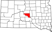
Oahe Acres is an unincorporated community and census-designated place (CDP) in Hughes County, South Dakota, United States. It was first listed as a CDP prior to the 2020 census.[2] The population of the CDP was 503 at the 2020 census.[4]
It is in the northwest part of the county, 7 miles (11 km) north of Pierre, the state capital, and 2 miles (3 km) east of Oahe Dam on the Missouri River.
Demographics
| Census | Pop. | Note | %± |
|---|---|---|---|
| 2020 | 503 | — | |
| U.S. Decennial Census[5] | |||
References
- ^ "ArcGIS REST Services Directory". United States Census Bureau. Retrieved October 15, 2022.
- ^ a b c U.S. Geological Survey Geographic Names Information System: Oahe Acres, South Dakota
- ^ "Census Population API". United States Census Bureau. Retrieved October 15, 2022.
- ^ "U.S. Census Bureau: Oahe Acres CDP, South Dakota". www.census.gov. United States Census Bureau. Retrieved December 28, 2021.
- ^ "Census of Population and Housing". Census.gov. Retrieved June 4, 2016.
- v
- t
- e
Municipalities and communities of Hughes County, South Dakota, United States
County seat: Pierre
- Oahe Acres
‡This populated place also has portions in an adjacent county or counties
- South Dakota portal
- United States portal
 | This South Dakota state location article is a stub. You can help Wikipedia by expanding it. |
- v
- t
- e


