San Rafael, Antioquia
Municipality and town in Antioquia Department, Colombia

Flag

Seal
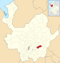
Location of the municipality and town of San Rafael, Antioquia in the Antioquia Department of Colombia
 Colombia
 Antioquia Department
[1]
(Census 2018[2])
San Rafael is a town and municipality in Antioquia Department, Colombia. Part of the subregion of Eastern Antioquia.
The town was founded in 1864 by a group of miners who were attracted to the abundance of gold in the region.[3] It is also rich in water resources.[3] The population was 12,578 at the 2018 census.
Climate
| Climate data for San Rafael (Violetas Las), elevation 1,016 m (3,333 ft), (1981–2010) | |||||||||||||
|---|---|---|---|---|---|---|---|---|---|---|---|---|---|
| Month | Jan | Feb | Mar | Apr | May | Jun | Jul | Aug | Sep | Oct | Nov | Dec | Year |
| Mean daily maximum °C (°F) | 28.3 (82.9) | 28.9 (84.0) | 29.0 (84.2) | 28.9 (84.0) | 29.2 (84.6) | 29.3 (84.7) | 29.3 (84.7) | 29.6 (85.3) | 28.9 (84.0) | 28.8 (83.8) | 28.2 (82.8) | 27.9 (82.2) | 28.9 (84.0) |
| Daily mean °C (°F) | 22.5 (72.5) | 22.7 (72.9) | 22.9 (73.2) | 23.0 (73.4) | 23.2 (73.8) | 23.1 (73.6) | 23.0 (73.4) | 23.1 (73.6) | 22.9 (73.2) | 22.6 (72.7) | 22.5 (72.5) | 22.5 (72.5) | 22.8 (73.0) |
| Mean daily minimum °C (°F) | 17.5 (63.5) | 17.7 (63.9) | 18.2 (64.8) | 18.5 (65.3) | 18.1 (64.6) | 18.0 (64.4) | 17.5 (63.5) | 17.4 (63.3) | 17.9 (64.2) | 18.0 (64.4) | 18.1 (64.6) | 18.0 (64.4) | 17.9 (64.2) |
| Average precipitation mm (inches) | 123.7 (4.87) | 149.7 (5.89) | 210.4 (8.28) | 354.4 (13.95) | 393.1 (15.48) | 310.2 (12.21) | 274.8 (10.82) | 346.3 (13.63) | 456.0 (17.95) | 488.2 (19.22) | 356.7 (14.04) | 198.1 (7.80) | 3,661.4 (144.15) |
| Average precipitation days (≥ 1.0 mm) | 13 | 14 | 17 | 22 | 23 | 20 | 19 | 20 | 23 | 25 | 23 | 17 | 233 |
| Average relative humidity (%) | 86 | 85 | 86 | 86 | 86 | 85 | 84 | 84 | 85 | 87 | 88 | 87 | 86 |
| Mean monthly sunshine hours | 151.9 | 141.2 | 136.4 | 135.0 | 151.9 | 165.0 | 198.4 | 192.2 | 168.0 | 148.8 | 132.0 | 130.2 | 1,851 |
| Mean daily sunshine hours | 4.9 | 5.0 | 4.4 | 4.5 | 4.9 | 5.5 | 6.4 | 6.2 | 5.6 | 4.8 | 4.4 | 4.2 | 5.1 |
| Source: Instituto de Hidrologia Meteorologia y Estudios Ambientales[4] | |||||||||||||
See also
External links
Wikimedia Commons has media related to San Rafael, Antioquia.
References
- ^ "Municipalities of Colombia". statoids. Retrieved 30 April 2020.
- ^ "Censo Nacional de Población y Vivienda 2018" (in Spanish). DANE. Retrieved 30 April 2020.
- ^ a b Pazera, John and Susan (2020-07-02). "Two Pleasant Colombian Towns: San Rafael and San Carlos". Latitude Adjustment. Retrieved 2022-07-13.
- ^ "Promedios Climatológicos 1981–2010" (in Spanish). Instituto de Hidrologia Meteorologia y Estudios Ambientales. Archived from the original on 15 August 2016. Retrieved 3 June 2024.
- v
- t
- e
Antioquia DepartmentCapital: Medellín
and
municipalities
| Southwestern | |
|---|---|
| Eastern | |
| Northeastern | |
| Northern | |
| Western | |
| Bajo Cauca | |
| Magdalena Medio | |
| Urabá | |
| Metropolitan Area of the Aburrá Valley |
Authority control databases | |
|---|---|
| International |
|
| National |
|
6°17′51″N 75°01′53″W / 6.2975°N 75.0314°W / 6.2975; -75.0314
 | This Department of Antioquia location article is a stub. You can help Wikipedia by expanding it. |
- v
- t
- e


