Tamburco District
District in Apurímac, Peru
Tamburco Tampurqu | |
|---|---|
District | |
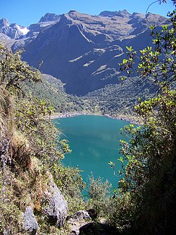 Ampay (in the background on the left) as seen from Usphaqucha | |
| Country |  Peru Peru |
| Region | Apurímac |
| Province | Abancay |
| Founded | December 31, 1941 |
| Capital | Tamburco |
| Government | |
| • Mayor | Fernando Zuñiga Gutierrez |
| Area | |
| • Total | 54.6 km2 (21.1 sq mi) |
| Elevation | 2,581 m (8,468 ft) |
| Population (2005 census) | |
| • Total | 7,216 |
| • Density | 130/km2 (340/sq mi) |
| Time zone | UTC-5 (PET) |
| UBIGEO | 030109 |
Tamburco District is one of the nine districts of the province Abancay in Peru.[1]
Climate
| Climate data for Granja San Antonio, Tamburco, elevation 2,772 m (9,094 ft), (1991–2020) | |||||||||||||
|---|---|---|---|---|---|---|---|---|---|---|---|---|---|
| Month | Jan | Feb | Mar | Apr | May | Jun | Jul | Aug | Sep | Oct | Nov | Dec | Year |
| Mean daily maximum °C (°F) | 20.9 (69.6) | 20.2 (68.4) | 20.3 (68.5) | 20.4 (68.7) | 20.9 (69.6) | 20.3 (68.5) | 20.3 (68.5) | 21.1 (70.0) | 22.2 (72.0) | 22.6 (72.7) | 23.3 (73.9) | 21.7 (71.1) | 21.2 (70.1) |
| Mean daily minimum °C (°F) | 8.9 (48.0) | 8.8 (47.8) | 8.8 (47.8) | 8.3 (46.9) | 7.3 (45.1) | 6.6 (43.9) | 6.0 (42.8) | 6.8 (44.2) | 8.3 (46.9) | 8.7 (47.7) | 9.1 (48.4) | 9.0 (48.2) | 8.0 (46.5) |
| Average precipitation mm (inches) | 198.5 (7.81) | 256.5 (10.10) | 97.4 (3.83) | 50.1 (1.97) | 15.2 (0.60) | 8.6 (0.34) | 8.6 (0.34) | 23.0 (0.91) | 15.4 (0.61) | 58.2 (2.29) | 64.4 (2.54) | 129.2 (5.09) | 925.1 (36.43) |
| Source: National Meteorology and Hydrology Service of Peru[2] | |||||||||||||
See also
References
- ^ (in Spanish) Instituto Nacional de Estadística e Informática. Banco de Información Digital Archived 2008-04-23 at the Wayback Machine. Retrieved April 4, 2008.
- ^ "Normales Climaticás Estándares y Medias 1991-2020". National Meteorology and Hydrology Service of Peru. Archived from the original on 21 August 2023. Retrieved 6 November 2023.

13°37′01″S 72°52′16″W / 13.61694°S 72.87111°W / -13.61694; -72.87111
 | This Apurímac Region geography article is a stub. You can help Wikipedia by expanding it. |
- v
- t
- e


