Topolovo
Place in Styria, Slovenia
46°6′18.13″N 15°29′11.84″E / 46.1050361°N 15.4866222°E / 46.1050361; 15.4866222 Slovenia
 (2002)
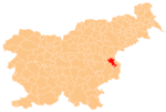
Topolovo (pronounced [tɔpɔˈlɔːʋɔ] or [tɔpɔˈloːʋɔ]) is a dispersed settlement in the Municipality of Kozje in eastern Slovenia. It lies in the Sava Hills (Slovene: Posavsko hribovje), west of Lesično. The area is part of the historical Styria region and is included in the Savinja Statistical Region.[2]
References
External links
- Topolovo on Geopedia
- v
- t
- e
Municipality of Kozje
Administrative seat: Kozje
- Bistrica
- Buče
- Dobležiče
- Drensko Rebro
- Gorjane
- Gradišče
- Gubno
- Ješovec pri Kozjem
- Klake
- Lesično
- Ortnice
- Osredek pri Podsredi
- Pilštanj
- Podsreda
- Poklek pri Podsredi
- Topolovo
- Vetrnik
- Vojsko
- Vrenska Gorca
- Zagorje
- Zdole
- Zeče pri Bučah