Výčapy-Opatovce
Municipality in Nitra Region, Slovakia
Výčapy-Opatovce Vicsápapáti | |
|---|---|
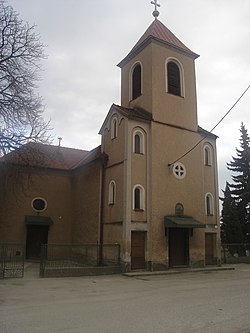 Church of all Saints | |
 Coat of arms | |
48°25′N 18°05′E / 48.42°N 18.08°E / 48.42; 18.08 | |
| Country |  Slovakia Slovakia |
| Region |  Nitra Region Nitra Region |
| District | Nitra District |
| First mentioned | 1247 |
| Area [1] | |
| • Total | 14.18 km2 (5.47 sq mi) |
| Elevation [2] | 152 m (499 ft) |
| Population (2021)[3] | |
| • Total | 2,153 |
| Time zone | UTC+1 (CET) |
| • Summer (DST) | UTC+2 (CEST) |
| Postal code | 951 44[2] |
| Area code | +421 37[2] |
| Car plate | NR |
| Website | www |
Výčapy-Opatovce (Slovak pronunciation: [ˈʋiːtʂapi ˈɔpatɔwtse]; Hungarian: Vicsápapáti) is a village and municipality in the Nitra District in western central Slovakia, in the Nitra Region. It lies on the halfway between Topoľčany and Nitra.
History
In historical records the village was first mentioned in 1247.
Geography
The village lies at an altitude of 155 metres and covers an area of 14.189 km2. It has a population of about 2180 people.
Coat of arms
The Coat of Arms of village Výčapy is from 1717 and represents vineyard knife and plough on the red field. The Coat of Arms of village Opatovce comes from the year 1781 and displays a lion climbing on the coniferous tree in the green meadow.
Both coats have been combined and recognized by heraldic committee, and authorized by municipal council. However, nobody knows who really owned the Opatovce's coat of arms.
Ethnicity
The population is about 93% Slovak and 7% Magyar.
References
- ^ "Hustota obyvateľstva - obce [om7014rr_ukaz: Rozloha (Štvorcový meter)]". www.statistics.sk (in Slovak). Statistical Office of the Slovak Republic. 2022-03-31. Retrieved 2022-03-31.
- ^ a b c "Základná charakteristika". www.statistics.sk (in Slovak). Statistical Office of the Slovak Republic. 2015-04-17. Retrieved 2022-03-31.
- ^ "Počet obyvateľov podľa pohlavia - obce (ročne)". www.statistics.sk (in Slovak). Statistical Office of the Slovak Republic. 2022-03-31. Retrieved 2022-03-31.
External links
- https://web.archive.org/web/20080111223415/http://www.statistics.sk/mosmis/eng/run.html
- Výčapy Opatovce
- Výčapy Opatovce, official pages
- v
- t
- e
Municipalities of Nitra District
- Alekšince
- Báb
- Babindol
- Bádice
- Branč
- Cabaj-Čápor
- Čab
- Čakajovce
- Čechynce
- Čeľadice
- Čifáre
- Dolné Lefantovce
- Dolné Obdokovce
- Golianovo
- Horné Lefantovce
- Hosťová
- Hruboňovo
- Ivanka pri Nitre
- Jarok
- Jelenec
- Jelšovce
- Kapince
- Klasov
- Kolíňany
- Lehota
- Lúčnica nad Žitavou
- Lukáčovce
- Lužianky
- Ľudovítová
- Malé Chyndice
- Malé Zálužie
- Malý Cetín
- Malý Lapáš
- Melek
- Mojmírovce
- Nitrianske Hrnčiarovce
- Nová Ves nad Žitavou
- Nové Sady
- Paňa
- Podhorany
- Pohranice
- Poľný Kesov
- Rišňovce
- Rumanová
- Svätoplukovo
- Štefanovičová
- Štitáre
- Šurianky
- Tajná
- Telince
- Veľká Dolina
- Veľké Chyndice
- Veľké Zálužie
- Veľký Cetín
- Veľký Lapáš
- Vinodol
- Výčapy-Opatovce
- Zbehy
- Žirany
- Žitavce

| Authority control databases: National |
|
|---|
 | This Nitra Region geography article is a stub. You can help Wikipedia by expanding it. |
- v
- t
- e


