Viktring
You can help expand this article with text translated from the corresponding article in German. Click [show] for important translation instructions.
- Machine translation, like DeepL or Google Translate, is a useful starting point for translations, but translators must revise errors as necessary and confirm that the translation is accurate, rather than simply copy-pasting machine-translated text into the English Wikipedia.
- Do not translate text that appears unreliable or low-quality. If possible, verify the text with references provided in the foreign-language article.
- You must provide copyright attribution in the edit summary accompanying your translation by providing an interlanguage link to the source of your translation. A model attribution edit summary is
Content in this edit is translated from the existing German Wikipedia article at [[:de:Viktring]]; see its history for attribution. - You may also add the template
{{Translated|de|Viktring}}to the talk page. - For more guidance, see Wikipedia:Translation.
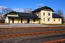
Viktring (Slovene: Vetrinj) is the 13th district of Klagenfurt, Carinthia, Austria.
History
The area was heavily affected by flooding in August 2023.[1][2]
Buildings
- Viktring Abbey
References
Wikimedia Commons has media related to Klagenfurt - Viktring.
Authority control databases | |
|---|---|
| International |
|
| National |
|
46°35′30″N 14°16′25″E / 46.59167°N 14.27361°E / 46.59167; 14.27361
- v
- t
- e


