Vohibinany (district)
Place in Tamatave, Madagascar
Brickaville Ampasimanolotra/Vohibinany | |
|---|---|
 Brickaville | |
| 18°49′10″S 49°04′25″E / 18.81944°S 49.07361°E / -18.81944; 49.07361 | |
| Country |  Madagascar Madagascar |
| Region | Tamatave |
| District | Vohibinany (district) |
| Area | |
| • Total | 5,385 km2 (2,079 sq mi) |
| Population (2020) | |
| • Total | 218,727 |
| • Density | 41/km2 (110/sq mi) |
| Time zone | UTC3 (EAT) |

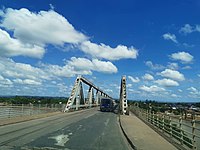
Brickaville District is an administrative district in Atsinanana Region, Madagascar; also known as Ampasimanolotra and Vohibinany. Brickaville is located along Route nationale 2 (RN 2), 105 km south of Toamasina (the primary seaport of the country) and 220 km east of Antananarivo (the capital).[1] It is also situated alongside the Rianila river. It is a railway station on the Antananarivo - East Coast line. Its main industries revolve around sugar.[2] The district has an estimated population in 2020 was 218,727.[3]
Communes
The district is further divided into 17 communes; which are further sub-divided into 180 villages (fokontany):
- Ambalarondra
- Ambinaninony
- Ambohimanana
- Ampasimbe
- Andekaleka
- Andevoranto
- Anivorano Est
- Anjahamana
- Brickaville (Vohibinany)
- Fanasana
- Fetraomby
- Lohariandava
- Mahatsara
- Maroseranana
- Ranomafana Est
- Razanaka
- Vohitranivona
Economy
The economy is based on agriculture. Lychee, Rice, coconuts and coffee are grown.[4] Since 2019 there is also a graphite mine in Fetraomby, the Sahamamy graphite mine.[5]
Roads
There are two mayor roads: the National Road 2 that leads from the capitol Antananarivo to Toamasina and the National Road 11a that leads from its junction with the national road 2 at Antsampanana south to Vatomandry.
References
- v
- t
- e
Capital: Toamasina
- Antanambao Manampotsy
- Antanandehibe
- Mahela
- Manaratsandry
- Manakana
- Saivaza

7 districts; 75 communes
 | This Madagascar location article is a stub. You can help Wikipedia by expanding it. |
- v
- t
- e


