Wetsens
Village in Friesland, Netherlands

Flag

Coat of arms
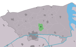
Location in the former Dongeradeel municipality
53°20′50″N 6°2′0″E / 53.34722°N 6.03333°E / 53.34722; 6.03333
 Netherlands
 Friesland
 (2021)[1]
9122[1]
Wetsens is a village in Noardeast-Fryslân in the province of Friesland, the Netherlands. It had a population of around 55 in January 2017.[3] and is considered to be one of the oldest villages in the north-east of Friesland. Before 2019, the village was part of the Dongeradeel municipality.[4]
The village was first mentioned in 1417 as Witzenser Therpe, and means "terp (artificial living mound) of the people of Wytse". See also Wetsinge.[5] The Dutch Reformed church dates from the 12th century. In 1842, the tower collapsed, and has been replaced by a simple belfry. In 1840, Wetsens was home to 131 people.[4]
References
- ^ a b c "Kerncijfers wijken en buurten 2021". Central Bureau of Statistics. Retrieved 1 April 2022.
- ^ "Postcodetool for 9122AA". Actueel Hoogtebestand Nederland (in Dutch). Het Waterschapshuis. Retrieved 1 April 2022.
- ^ Aantal inwoners per woonplaats in Dongeradeel op 1 januari 2017 - Dongeradeel
- ^ a b "Wetsens". Plaatsengids (in Dutch). Retrieved 1 April 2022.
- ^ "Wetsens - (geografische naam)". Etymologiebank (in Dutch). Retrieved 1 April 2022.
External links
![]() Media related to Wetsens at Wikimedia Commons
Media related to Wetsens at Wikimedia Commons
- v
- t
- e
Populated places in the municipality of Noardeast-Fryslân
- Dokkum
- Former municipalities: Dongeradeel
- Ferwerderadiel
- Kollumerland en Nieuwkruisland
- Aalsum
- Anjum
- Augsbuurt
- Blije
- Bornwird
- Brantgum
- Burdaard
- Burum
- Ee
- Engwierum
- Ferwert
- Foudgum
- Ginnum
- Hallum
- Hantum
- Hantumhuizen
- Hegebeintum
- Hiaure
- Holwerd
- Jannum
- Jislum
- Jouswier
- Kollum
- Kollumerpomp
- Kollumerzwaag
- Lichtaard
- Lioessens
- Marrum
- Metslawier
- Moddergat
- Morra
- Munnekezijl
- Nes
- Niawier
- Oosternijkerk
- Oostmahorn
- Oostrum
- Oudwoude
- Paesens
- Raard
- Reitsum
- Ternaard
- Triemen
- Veenklooster
- Waaxens
- Wânswert
- Warfstermolen
- Westergeest
- Wetsens
- Wierum
- Zwagerbosch
- Bartlehiem (partially)
- Betterwird
- Hantumeruitburen
- Westernijtsjerk
 | This Friesland location article is a stub. You can help Wikipedia by expanding it. |
- v
- t
- e


