Windham, Montana
Census-designated place in Montana, United States
47°4′42″N 110°8′26″W / 47.07833°N 110.14056°W / 47.07833; -110.14056 (2020)
59479 (Stanford)
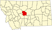
Windham is a census-designated place (CDP) in Judith Basin County, Montana, United States. It is in the center of the county along U.S. Route 87, Montana Highway 200 and 3. The town is 6 miles (10 km) southeast of Stanford, the county seat, and 38 miles (61 km) west of Lewistown.
Windham is in the valley of Sage Creek, a northeast-flowing tributary of the Judith River, which continues north to the Missouri River.
The community was first listed as a CDP prior to the 2020 census.[2]
The Judith Basin Press is the local newspaper.[3] It is published weekly.
Demographics
| Census | Pop. | Note | %± |
|---|---|---|---|
| 2020 | 43 | — | |
| U.S. Decennial Census[4] | |||
References
- ^ "ArcGIS REST Services Directory". United States Census Bureau. Retrieved September 5, 2022.
- ^ a b c "Windham Census Designated Place". Geographic Names Information System. United States Geological Survey, United States Department of the Interior.
- ^ "News". Judith Basin Press. Retrieved September 4, 2023.
- ^ "Census of Population and Housing". Census.gov. Retrieved June 4, 2016.
- v
- t
- e
Municipalities and communities of Judith Basin County, Montana, United States
County seat: Stanford
community
- Montana portal
- United States portal
 | This Judith Basin County, Montana state location article is a stub. You can help Wikipedia by expanding it. |
- v
- t
- e


