Newfoundland and Labrador Route 434
 | |||||
 | |||||
| Route 434 in de omgeving van Conche | |||||
| Newfoundland and Labrador Route 434 | |||||
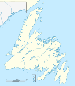
| Land | Canada | ||||
| Provincie | Newfoundland en Labrador | ||||
| Lengte | 24 km | ||||
| |||||
| Traject | |||||
| |||||


Newfoundland and Labrador Route 434 (NL-434) is een 24 km lange provinciale weg in de Canadese provincie Newfoundland en Labrador.[1] De weg, ook wel Conche Road of Martinique Drive genoemd, bevindt zich in het uiterste noorden van het eiland Newfoundland.
Route 434 ligt in het oosten van het Great Northern Peninsula en is de enige toegangsweg tot het afgelegen kustdorpje Conche. De weg verbindt Conche met provinciale route 433.
De Canadian Automobile Association plaatste de weg in 2016 op de tweede plaats in hun lijst van slechtste wegen in Atlantisch Canada.[2]
Traject

Conche
Roddickton
Begin- en eindpunt van Route 434
Route 434 begint als aftakking van Route 433, aan de noordrand van het dorp Roddickton. De weg gaat dan over z'n hele traject doorheen het binnenland om uiteindelijk Conche te bereiken, een kustplaats met 170 inwoners (2016).[3] Er ligt geen enkel ander dorp op het traject.
Route 434 is het startpunt van een aantal grindwegen die leiden naar Coles Pond, een meer met een aantal vakantiewoningen langs zijn oevers.
Bronnen, noten en/of referenties
- ↑ (en) (fr) MapArt, Canada back road atlas / atlas des rangs et chemins, Oshawa, 2008, pp. 553. ISBN 978-1-55368-614-9
- ↑ (en) CBC News, "Atlantic Canada's 'worst road' may lose infamous status, thanks to paving contract", 17 mei 2016. Geraadpleegd op 1 oktober 2023.
- ↑ (en) Statistics Canada, 'Population and Dwelling Count Highlight Tables, 2016 Census (Newfoundland en Labrador)'.


Provinciale routes in Newfoundland en Labrador
| Nationale wegen: | 1 (TCH) · 2 · 40 · 100 · 340 · 350 · 430 · 450A · 500 (TLH) · 510 (TLH) |
| Schiereiland Avalon: | 1 (TCH) · 2 · 3 · 3A · 10 · 11 · 13 · 20 · 21 · 30 · 40 · 41 · 50 · 60 · 62 · 63 · 70 · 71 · 72 · 73 · 74 · 75 · 80 · 81 · 90 · 91 · 92 · 93 · 94 · 100 · 101 · 102 · 201 · 202 · 203 |
| Schiereiland Burin: | 210 · 211 · 212 · 213 · 214 · 220 · 220A · 221 · 222 |
| Schiereiland Bonavista: | 204 · 205 · 230 · 230A · 231 · 232 · 233 · 234 · 235 · 236 · 237 · 238 · 239 |
| Regio Twillingate—Fogo Island: | 301 · 310 · 320 · 330 · 331 · 332 · 333 · 334 · 335 · 340 · 341 · 342 · 343 · 344 · 345 · 346 |
| Regio Exploitsvallei—Bay d'Espoir: | 1 (TCH) · 350 · 351 · 352 · 353 · 360 · 361 · 362 · 363 · 364 · 365 · 370 · 371 |
| Schiereiland Baie Verte: | 380 · 381 · 382 · 390 · 391 · 392 · 410 · 411 · 412 · 413 · 414 · 415 · 416 · 417 · 418 · 419 |
| Great Northern Peninsula: | 401 · 420 · 421 · 422 · 430 · 432 · 433 · 434 · 435 · 436 · 437 · 438 |
| Westelijk Newfoundland: | 1 (TCH) · 402 · 403 · 404 · 405 · 406 · 407 · 408 · 431 · 440 · 450 · 450A · 460 · 461 · 462 · 463 · 470 · 480 · 490 |
| Labrador: | 500 (TLH) · 503 · 510 (TLH) · 513 · 514 · 516 · 520 |


