Parson's Pond
Plaats in Canada  | |||
|---|---|---|---|
  | |||
| Situering | |||
| Provincie | Newfoundland en Labrador | ||
| Censusdivisie | Divisie Nr. 9 | ||
| Regional service board | Western Region | ||
| Coördinaten | 50° 2′ NB, 57° 42′ WL | ||
| Algemeen | |||
| Oppervlakte | 12,34 km² | ||
| Inwoners (2021) | 368 (29,8 inw./km²) | ||
| Overig | |||
| Netnummer | 709 | ||
| Tijdzone | UTC−3:30 | ||
| Foto's | |||
 | |||
| Gebouwen in de haven van Parson's Pond | |||
| |||

Parson's Pond is een gemeente (town) in de Canadese provincie Newfoundland en Labrador.
Geschiedenis
In 1966 werd het dorp een gemeente met de status van local government community (LGC).[1][2] In 1980 werden LGC's op basis van The Municipalities Act als bestuursvorm afgeschaft. De gemeente werd daarop automatisch een community om een aantal jaren later uiteindelijk een town te worden.[1]
Geografie
De gemeente ligt in het westen van het Great Northern Peninsula aan de noordwestkust van het eiland Newfoundland. Parson's Pond ligt 7 km ten noorden van het Nationaal Park Gros Morne en 10 km ten zuiden van The Arches Provincial Park. De plaats is bereikbaar via provinciale route 430.
Demografie
Demografisch gezien is Parson's Pond, net zoals de meeste kleine dorpen op Newfoundland, aan het krimpen. Tussen 1991 en 2021 daalde de bevolkingsomvang van 582 naar 368. Dat komt neer op een daling van 214 inwoners (-36,8%) in dertig jaar tijd.
| Demografische ontwikkeling van Parson's Pond tussen 1991 en 2021 |
|---|
 |
| Bron: Statistics Canada (1991–1996[3], 2001–2006[4], 2011–2016[5], 2021[6]) |
Gezondheidszorg
Gezondheidszorg wordt in de gemeente aangeboden door de Parson's Pond Clinic. Deze lokale zorginstelling valt onder de bevoegdheid van de gezondheidsautoriteit Western Health en biedt de inwoners van Parson's Pond en omgeving alledaagse eerstelijnszorg aan.[7] De medische kliniek is bemand door een verpleegkundige (nurse practitioner), gesteund door de regelmatige aanwezigheid van een bezoekend arts, en biedt ook gemeenschapsgezondheidsverpleegkunde (community health nursing) aan.[7]
Galerij
-
 Zicht op het dorp
 -
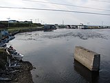 Haven van Parson's Pond
 -
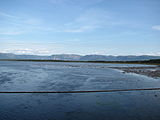 Zich op het Nationaal Park Gros Morne vanaf het dorp


Zie ook
Bronnen, noten en/of referenties
- ↑ a b (en) Government of Newfoundland and Labrador, Historical Statistics of Newfoundland and Labrador, 1988, table A-9.
- ↑ (en) Statistics Canada, 1976 Census of Canada. Population: Geographic Distributions. Census Divisions and Subdivisions: Atlantic Provinces, table 3.
- ↑ (en)
 Statistics Canada, 'Population of Communities by Census Consolidated Subdivision (CCS). Newfoundland and Labrador, 1991 and 1996 Census', 1998.
 - ↑ (en) Statistics Canada, 'Population of Communities by Census Consolidated Subdivision (CCS). Newfoundland and Labrador, 2006 Census', 2009.
- ↑ (en) Statistics Canada, '2016 Census Population, by 2011 Census Consolidated Subdivision (CCS) by Community, Newfoundland and Labrador', 2018.
- ↑ (en) Statistics Canada, 'Population and dwelling counts: Canada, provinces and territories, census divisions and census subdivisions (municipalities)', table: 98-10-0002-03 (geographic name: Newfoundland and Labrador), 2022.
- ↑ a b (en) Western Health, 'Medical Clinics (Primary Care)'[dode link], 2016. Geraadpleegd op 27 november 2020.


