Marlin, Pennsylvania
CDP in Pennsylvania, United States
40°40′50″N 76°14′39″W / 40.68056°N 76.24417°W / 40.68056; -76.24417[1]
(2020)[2]
17951
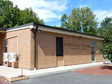
Marlin, or MarLin (pronounced mar-LIN) is a census-designated place (CDP) in Schuylkill County, Pennsylvania, United States. The population was 640 at the 2000 census. It is a village of Norwegian Township. The village is the seat of government for the township.
Geography
Marlin is located at 40°40′50″N 76°14′39″W / 40.68056°N 76.24417°W / 40.68056; -76.24417 (40.680503, -76.244204).[3]
According to the United States Census Bureau, the CDP has a total area of 0.9 square miles (2.3 km2), all land.
Demographics
| Census | Pop. | Note | %± |
|---|---|---|---|
| 2020 | 299 | — | |
| U.S. Decennial Census[4] | |||
At the 2000 census there were 640 people, 269 households, and 181 families living in the CDP. The population density was 710.5 inhabitants per square mile (274.3/km2). There were 278 housing units at an average density of 308.6 per square mile (119.2/km2). The racial makeup of the CDP was 99.38% White and 0.62% African American. Hispanic or Latino of any race were 0.47%.[5]
Of the 269 households, 33.5% had children under the age of 18 living with them, 53.2% were married couples living together, 8.2% had a female householder with no husband present, and 32.7% were non-families. 30.5% of households were one person and 19.3% were one person aged 65 or older. The average household size was 2.38 and the average family size was 2.96.
The age distribution was 24.8% under the age of 18, 4.7% from 18 to 24, 28.0% from 25 to 44, 22.2% from 45 to 64, and 20.3% 65 or older. The median age was 40 years. For every 100 females, there were 99.4 males. For every 100 females age 18 and over, there were 83.6 males.[citation needed]
The median household income was $42,692 and the median family income was $51,106. Males had a median income of $41,000 versus $22,083 for females. The per capita income for the CDP was $19,122. None of the families and 4.9% of the population were living below the poverty line, including no under eighteens and 14.6% of those over 64.
Gallery
-
 Fire Co. and War Memorial.
 -
 Spruce Street.
 -


References
- ^ "ArcGIS REST Services Directory". United States Census Bureau. Retrieved October 12, 2022.
- ^ "Census Population API". United States Census Bureau. Retrieved Oct 12, 2022.
- ^ "US Gazetteer files: 2010, 2000, and 1990". United States Census Bureau. 2011-02-12. Retrieved 2011-04-23.
- ^ "Census of Population and Housing". Census.gov. Retrieved June 4, 2016.
- ^ "U.S. Census website". United States Census Bureau. Retrieved 2008-01-31.
Wikimedia Commons has media related to Marlin, Pennsylvania.
- v
- t
- e
Municipalities and communities of Schuylkill County, Pennsylvania, United States
County seat: Pottsville

- Ashland‡
- Auburn
- Coaldale
- Cressona
- Deer Lake
- Frackville
- Gilberton
- Girardville
- Gordon
- Landingville
- Mahanoy City
- McAdoo
- Mechanicsville
- Middleport
- Minersville
- Mount Carbon
- New Philadelphia
- New Ringgold
- Orwigsburg
- Palo Alto
- Pine Grove
- Port Carbon
- Port Clinton
- Ringtown
- Schuylkill Haven
- Shenandoah
- St. Clair
- Tamaqua
- Tower City
- Tremont
- Barry
- Blythe
- Branch
- Butler
- Cass
- Delano
- East Brunswick
- East Norwegian
- East Union
- Eldred
- Foster
- Frailey
- Hegins
- Hubley
- Kline
- Mahanoy
- New Castle
- North Manheim
- North Union
- Norwegian
- Pine Grove
- Porter
- Reilly
- Rush
- Ryan
- Schuylkill
- South Manheim
- Tremont
- Union
- Upper Mahantongo
- Walker
- Washington
- Wayne
- West Brunswick
- West Mahanoy
- West Penn
- Altamont
- Beurys Lake
- Branchdale
- Brandonville
- Brockton
- Buck Run
- Cumbola
- Delano
- Donaldson
- Duncott
- Englewood
- Forestville
- Fountain Springs
- Friedensburg
- Grier City
- Heckscherville
- Hegins
- Hometown
- Kelayres
- Klingerstown
- Lake Wynonah
- Lavelle
- Llewellyn
- Locustdale‡
- Marlin
- Maryd
- McKeansburg
- Morea
- Muir
- New Boston
- Newtown
- Nuremberg‡
- Oneida
- Orwin
- Park Crest
- Park Place
- Ravine
- Reinerton
- Renningers
- Seltzer
- Shenandoah Heights
- Sheppton
- Summit Station
- Tuscarora
- Valley View
communities
‡This populated place also has portions in an adjacent county or counties
- Pennsylvania portal
- United States portal


