Muir, Pennsylvania
Census-designated place in Pennsylvania, United States
Muir, Pennsylvania | |
|---|---|
census-designated place | |
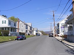 Photo along Wiconisco Avenue | |
| Country | United States |
| State | Pennsylvania |
| County | Schuylkill |
| Area [1] | |
| • Total | 0.50 sq mi (1.29 km2) |
| • Land | 0.50 sq mi (1.29 km2) |
| • Water | 0.00 sq mi (0.00 km2) |
| Population (2020)[2] | |
| • Total | 429 |
| • Density | 863.18/sq mi (333.55/km2) |
| Time zone | UTC-5 (Eastern (EST)) |
| • Summer (DST) | UTC-4 (EDT) |
| FIPS code | 42-52224 |
Muir is a census-designated place[3] located in Porter Township, Schuylkill County in the state of Pennsylvania, United States. Muir was part of the Reinerton-Orwin-Muir CDP at the 2000 census before splitting into three individual CDPs for the 2010 census. The other communities, along with Muir are Reinerton and Orwin. The community is located near the borough of Tower City along U.S. Route 209. As of the 2010 census,[4] the population was 451 residents.
Demographics
| Census | Pop. | Note | %± |
|---|---|---|---|
| 2020 | 429 | — | |
| U.S. Decennial Census[5] | |||
References
- ^ "ArcGIS REST Services Directory". United States Census Bureau. Retrieved October 12, 2022.
- ^ "Census Population API". United States Census Bureau. Retrieved October 12, 2022.
- ^ [1][dead link]
- ^ https://www.census.gov/# [not specific enough to verify]
- ^ "Census of Population and Housing". Census.gov. Retrieved June 4, 2016.
- v
- t
- e
Municipalities and communities of Schuylkill County, Pennsylvania, United States
County seat: Pottsville

- Ashland‡
- Auburn
- Coaldale
- Cressona
- Deer Lake
- Frackville
- Gilberton
- Girardville
- Gordon
- Landingville
- Mahanoy City
- McAdoo
- Mechanicsville
- Middleport
- Minersville
- Mount Carbon
- New Philadelphia
- New Ringgold
- Orwigsburg
- Palo Alto
- Pine Grove
- Port Carbon
- Port Clinton
- Ringtown
- Schuylkill Haven
- Shenandoah
- St. Clair
- Tamaqua
- Tower City
- Tremont
- Barry
- Blythe
- Branch
- Butler
- Cass
- Delano
- East Brunswick
- East Norwegian
- East Union
- Eldred
- Foster
- Frailey
- Hegins
- Hubley
- Kline
- Mahanoy
- New Castle
- North Manheim
- North Union
- Norwegian
- Pine Grove
- Porter
- Reilly
- Rush
- Ryan
- Schuylkill
- South Manheim
- Tremont
- Union
- Upper Mahantongo
- Walker
- Washington
- Wayne
- West Brunswick
- West Mahanoy
- West Penn
- Altamont
- Beurys Lake
- Branchdale
- Brandonville
- Brockton
- Buck Run
- Cumbola
- Delano
- Donaldson
- Duncott
- Englewood
- Forestville
- Fountain Springs
- Friedensburg
- Grier City
- Heckscherville
- Hegins
- Hometown
- Kelayres
- Klingerstown
- Lake Wynonah
- Lavelle
- Llewellyn
- Locustdale‡
- Marlin
- Maryd
- McKeansburg
- Morea
- Muir
- New Boston
- Newtown
- Nuremberg‡
- Oneida
- Orwin
- Park Crest
- Park Place
- Ravine
- Reinerton
- Renningers
- Seltzer
- Shenandoah Heights
- Sheppton
- Summit Station
- Tuscarora
- Valley View
communities
‡This populated place also has portions in an adjacent county or counties
- Pennsylvania portal
- United States portal
40°35′33″N 76°31′07″W / 40.59250°N 76.51861°W / 40.59250; -76.51861


