Mongping State
| Mongping State Möngping | |||||||
|---|---|---|---|---|---|---|---|
| State of the Shan States | |||||||
| 17th century–1842 | |||||||
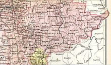 Möngping State in an Imperial Gazetteer of India map | |||||||
| Capital | Mong Ping (Lawksawk) | ||||||
| History | |||||||
• Founded as vassal state of Lawksawk | 17th century | ||||||
• Annexed by Lawksawk | 1842 | ||||||
| |||||||
Mongping or Möngping (Burmese: Maingpyin) was the smallest state of the Shan States in what is today Burma.
History
Little is known about the history of this state except that in 1842 it was merged with Lawksawk.[1] It was located at the southeastern end of that state, separated from it by the Nam Et River.
Rulers
- 1835 - 1842 Hkam Hlaing
- 1842 - .... Hkam Kaw
References
- ^ Ben Cahoon (2000). "World Statesmen.org: Shan and Karenni States of Burma". Retrieved 21 December 2010.
- v
- t
- e
- Hsenwi State
- Mongmit
- Hsipaw
- North Hsenwi
- South Hsenwi
- Hsumhsai
- Manglon
- Mongleng
- Monglong
- Mongtung
- Tawngpeng
Eastern Division
Central Division
Myelat Division
Kengtung & Yawnghwe
- Federated Shan states
- List of rulers of Shan states
- Princely state
- Saopha
21°2′N 97°6′E / 21.033°N 97.100°E / 21.033; 97.100
 | This Burmese history article is a stub. You can help Wikipedia by expanding it. |
- v
- t
- e
 | This Shan State location article is a stub. You can help Wikipedia by expanding it. |
- v
- t
- e


